

Re-establishing and maintaining Lincolnville’s historic vistas within Camden Hills State Park.
These sites include Cameron Knob, Cameron Field, Poverty Knoll, and the Millerite Field.
Cameron Mountain
Cameron Knob
Cameron Field
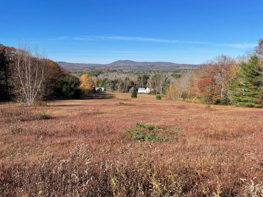
The Cameron Knob and Cameron Field sites contain about nine and four acres, respectively, and are located on what official maps call Cameron Mountain. They are separated by a steep sloped, wooded section, and have been used for agricultural purposes for many generations. This strong local agricultural tradition is reflected in the nearby local winery where grapes are grown, harvested and processed into high quality wine.
The name of the mountain is rooted deeply in the history of Lincolnville’s founding families. During the late 1700’s and early 1800’s, two founding families, Dean and Wadsworth, had established large family farms. A section of land located near Steven’s corner, at the intersection of Beach Road and Youngtown Road was originally called Dean Town. It was fairly common for the children of the founding families to intermarry and continue to work the farms, mills and other enterprises they inherited. In 1873 Caroline E. Dean married Sedate M. Wadsworth, grandson of Sedate Wadsworth Jr., (see Poverty Knoll description). They divorced in 1877 and Caroline remarried George R. Cameron, who had come from Yarmouth, Nova Scotia, Canada to Camden. They had two sons, George and Ralph, and it is thought that, as they and their descendants worked the land, the mountain location was named after them.
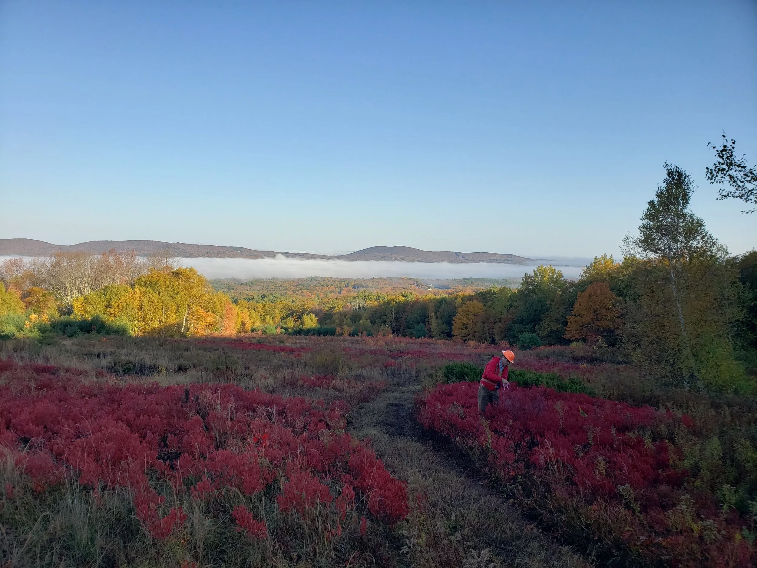
For much of the 1900’s the sites were managed as family-owned blueberry fields. Incorporation into the Camden Hills State Park (CHSP) occurred in 2006. At that time, it was noted that access was becoming impeded, and the spectacular views and other significant values enjoyed by hikers and picnickers were in danger of being lost as the field became overgrown. In response, a collaborative effort between the CHSP and the Lincolnville Hills Project (a 501(c)3 charitable organization) began working to restore this site to its historic mixed growth of wild low-bush blueberry plants, wildflowers, grasses and a wide variety of low-profile vegetation. This open habitat, in addition to maintaining spectacular views and recreational opportunities, provides important support to a wide variety of both permanent and transient wildlife that depend on this type of habitat for their survival. It also provides areas of fire breaks in the event of forest fires.
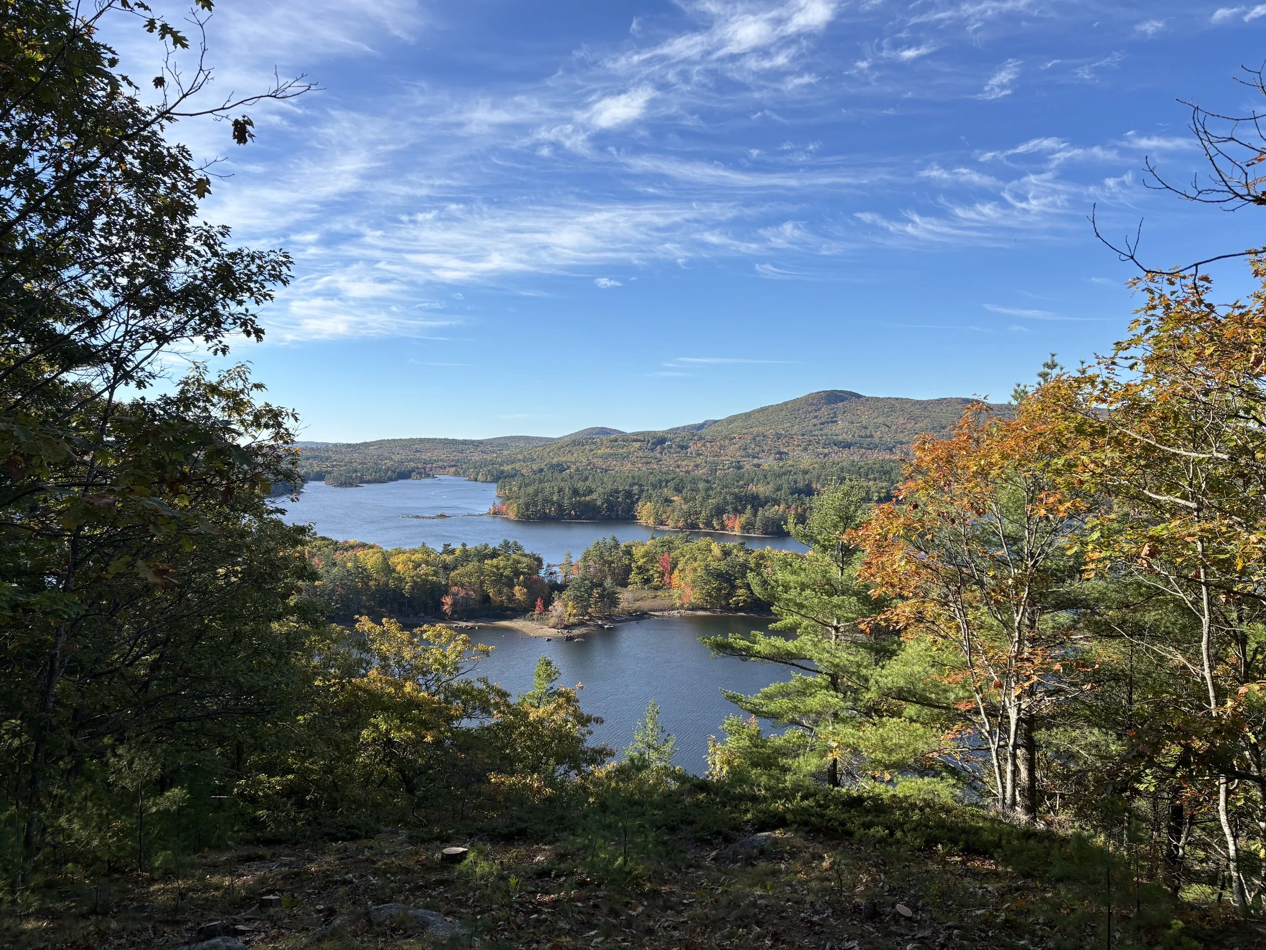
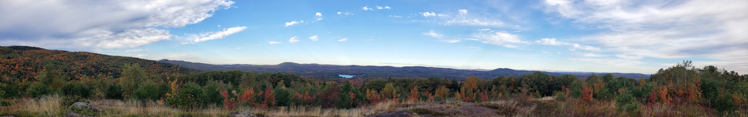
The view west, across the Lincolnville valley, reveals a part of Megunticook Lake, and Moody and Levenseller mountains. Looking east, Penobscot Bay and the coast toward Mt. Desert Island can be seen.
Poverty Knoll
How did the site get the name Poverty Knoll? Oral histories passed down by descendants of the founding families tell of a time, from the depression during the late 1800’s through the great depression of the 1930’s, when the site was the location of the town’s poorhouse. It provided shelter and aid to impoverished residents, reflecting the period practices of local welfare. Other stories tell of families with large numbers of foster children living at the site. By the 1950’s the site was being managed as a blueberry field by descendants of the Young family, which continued up until the site was incorporated into the Camden Hills Sate Park.
The Poverty Knoll site, comprised of about four acres, has a rich and varied history that reveals much about Lincolnville’s early settlers and the socio-economic forces that influenced them. The site is located along the original mountain road that connected Lincolnville to Camden through the Millerite Field. Historical records indicate that Sedate Wadsworth Sr. (1730-1812), a Revolutionary War veteran, was an early settler of Camden/Lincolnville. He had at least nine children. One son, Sedate Wadsworth Jr. (1775-1846), continued the family legacy in Lincolnville, marrying Susan Hassen. They had 12 children, including Sedate Wadsworth III (1800-1880). Sedate Wadsworth III was a farmer who lived his entire life in Lincolnville, marrying twice and raising multiple children. Phoebe Wadsworth (1772-1846), daughter of Sedate, Sr., married Gideon Young Jr., another founding family descendent, reflecting the intertwined histories of prominent Lincolnville families.
Stone remnants of the Wadsworth house, barn, access road and field boundaries give clear evidence of the extended period this site was occupied. In the winter and spring of 1831, three sons of Sedate Wadsworth Jr., named Abiah, Charles and Jeremiah, built a 58-ton schooner on the hillside. Abiah was 21 years old at the time. He and his brothers were accomplished carpenters and shipbuilders, which was common in coastal Maine during the 19th century due to the region’s thriving shipbuilding industry. Abiah recorded that it took five days of hauling the ship over 4.5 miles to Camden where it was launched, and that some days they had “one hundred pair of oxen on it to draw it.” Significant artifacts from the site include a copper spike of the type used in ship construction and a civil war button found near the house cellar foundation.
The Millerite Field
Although no longer the main way to Camden, the mountain road continued for some time to provide access to farms, agricultural fields and the stunning views overlooking the valley of Lincolnville and Megunticook Lake. It had special significance for a particular group of early Lincolnville citizens. In the mid-19th century, the local following of the Protestant Millerite sect, which was a part of the broader Millerite religious movement throughout New England, participated in an event that still lives on in Lincolnville’s historical memory. A group of Millerites anticipated Christ’s return on October 22, 1844, and gathered to await the Second Coming. They chose the mountain road through what is now the Millerite Field to gather at the Millerite Ledges on Mount Megunticook, but the day passed uneventfully and became known as “The Day of the Great Disappointment.” The local Lincolnville community responded with resilience and compassion. With winter near at hand, neighbors helped Millerites recover from their losses, as many had sold possessions and abandoned their livelihoods in preparation for the end of the world. The local community features an annual commemorative hike over the route and provides historical discussions of the event.
On the spring day of May 7, 1864, a 12-year-old girl named Elenora French followed the mountain road through the Millerite Field to picnic with family and friends on a scenic cliff overlooking the Lincolnville valley. It is said a gust of wind blew her hat off, and in an attempt to catch it, she fell and sustained fatal injuries. To commemorate that event, a large white memorial cross was erected and the site named Maiden Cliff. The original cross has been repaired and replaced several times, and has been featured in movies reflecting the religious, historic and cultural heritage of the community.
The location of the Millerite Field also has a notable geopolitical aspect. It sits at the boundary of two counties, Knox and Waldo, and two towns, Lincolnville and Camden, and is now contained within the Camden Hills State Park. Throughout most of the 20th century, it was maintained as a privately owned blueberry field, with many local youths participating in the annual raking harvest of blueberries. The numerous descendants of the early landowners maintained that the people of the local community should always have access by way of the mountain road to the Millerite Field, Maiden Cliff and the Millerite Ledges, recognizing their historical importance to the whole community.
The Millerite Field, comprising about seven acres, holds historical significance to the town of Lincolnville for several reasons. Prior to Lincolnville’s incorporation in 1802, this field and the valley below were known as the Plantation of Canaan, in reference to the biblical “Land of Canaan” symbolizing a fertile and promising land. This name was common among settlers who associated the area’s natural beauty and agricultural potential with the biblical reference. The area was initially settled in 1770 by Nathan Knight, and by 1790 it had a population of 278 people. The main wagon route to the nearby settlement of what was to become Camden was through this field and over the Megunticook mountain range. Early settler wagon routes frequently incorporated existing native American foot trails as the best way to go places, so it is plausible that this route was used long before European settlement of the region. Stone cellar remains along the route give witness to the foundational importance of this first road to the community. If you stand at the top end of the field and look west across the valley, you can get a good sense of what early settlers saw as they entered the land of milk and honey.
Construction of the Turnpike Road, now known as Route 52, was conducted between1802 and 1806. Daniel Barrett led the effort to build the road along the edge of Megunticook Lake, using labor from about 40 men, including four enslaved individuals. The road, originally a private toll route, provided a more direct path between Camden and Lincolnville, thus replacing the mountain road, and encouraging settlement and businesses along the new route.
Overview of The Sites

So how did it happen that the four Lincolnville Hills Project sites got to be part of the Camden Hills State Park? As you may guess with many things rooted in the local history of Lincolnville, it is a story of land transfers between founding family descendants through intermarriage, the changing economics of wild blueberry agriculture, and the increasing local population and its resulting impact on land use, property valuations, and taxes.
Many local residents remember Fred and Marion Milliken during the mid-20th century, when they owned and managed several blueberry fields in Lincolnville. Community members, including many local youths, would participate in the seasonal burning of the fields and the harvesting of blueberries in what was called “blueberry raking”. As anyone who participated in this activity will attest, it was backbreaking work with meager pay, but it did have its advantages. It provided a source of income where little else was available, girls and boys worked together and got the chance to socialize, and it was a great teaching experience in how much labor it took to make a dollar.
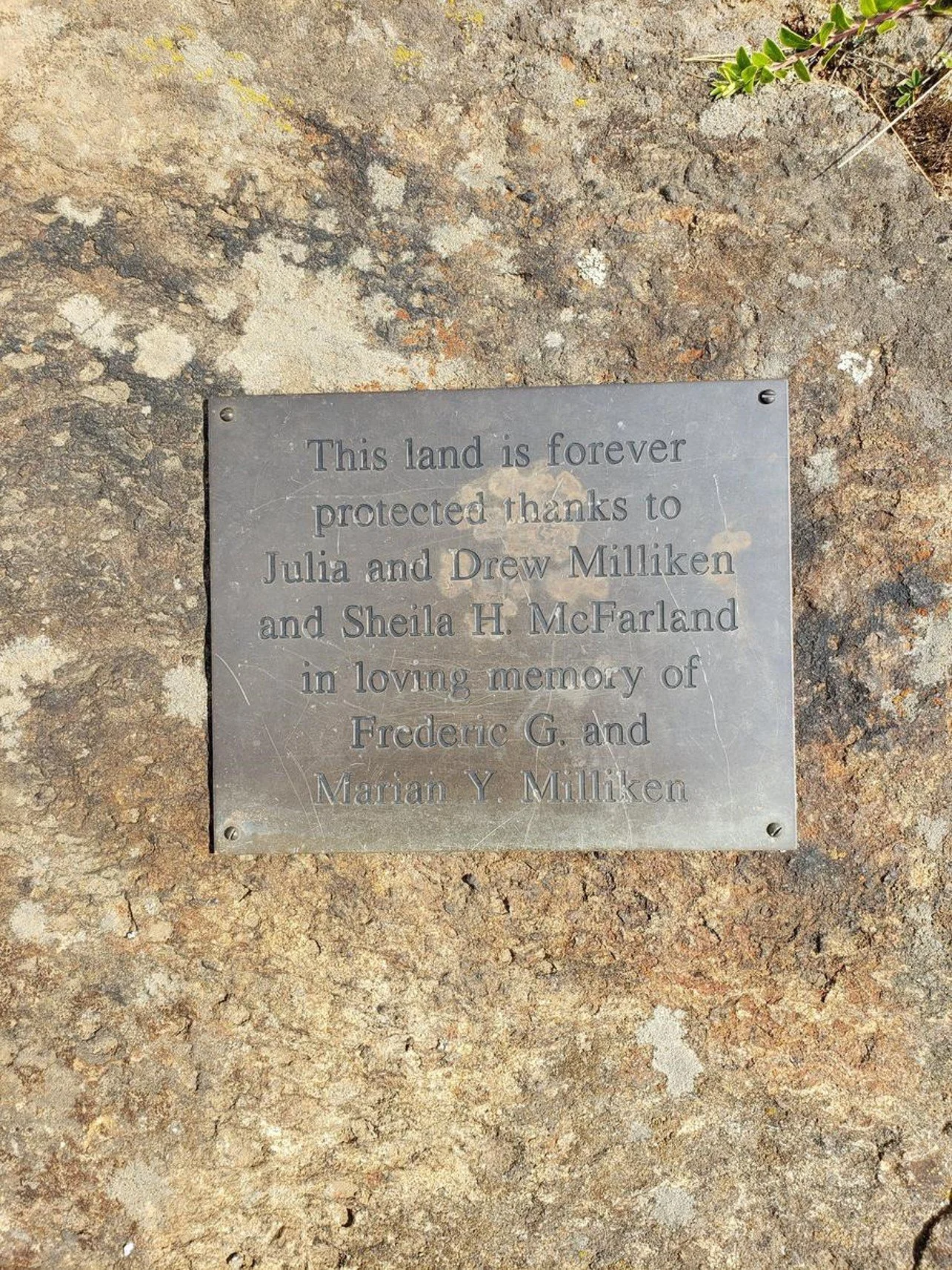
Fred Milliken family’s presence in Lincolnville dates back at least to the early 1800’s. Marion Young was a descendent of the founding Lincolnville Young family. They were married in 1940, and the fields they inherited had been in the family’s hands for generations, serving as sites for farming, blueberry cultivation, and neighborhood cooperation. The Millikens were very generous in letting people continue to use the established access to and through the fields. Marion in particular knew of the historical significance of the sites and felt that people should be able to continue to access these scenic and historical sites as long as they were respectful of the agricultural activities.
In March 2006, the Milliken family sold approximately 90 acres to the Nature Conservancy, which in partnership with Coastal Mountains Land Trust, managed the property until it was transferred to the Camden Hills State Park. Key participants in this transaction were Fred and Marion’s son Drew and lifelong resident and Lincolnville founding family descendent, Shelia Hart McFarland. Together they facilitated the transfer of the properties with three primary objectives in mind.
· Protect the land from development and preserve its natural and agricultural heritage for future generations.
· Ensure the continued public access for recreation, education and enjoyment
· Support conservation efforts that maintain important habitats for wildlife and native plants
The Lincolnville Hills Project in partnership with the Camden Hills State Park is dedicated to maintaining these key objectives.

Our Organization
LHP Board members are:
David Kelley (president)
Dwight Emerson (secretary)
Hayden Sears (treasurer)
Becky Johnson (outreach coordinator)
Sandy Cameron (webmaster)
The LHP is an IRS code section 501(c)(3) organization (a nonprofit organization for general charitable purposes) to fund and oversee the conduct of the reestablishment and maintenance of these important sites.
Contribute
Your monetary contribution or voluntary participation toward re-establishing and maintaining these historic vista’s is most welcome and greatly appreciated!